Geography
Antarctica
Antarctica is the southernmost continent, located almost entirely within the Antarctic Circle. It is the fifth-largest continent and is covered by ice that averages 1.9 kilometers in thickness. Antarctica is known for its extreme cold, unique wildlife such as penguins and seals, and its importance in scientific research related to climate change and environmental studies.
Written by Perlego with AI-assistance
Related key terms
1 of 5
12 Key excerpts on "Antarctica"
- Philip C. Jessup, Howard J. Taubenfeld(Authors)
- 2019(Publication Date)
- Columbia University Press(Publisher)
5. The Antarctic The Antarctic is defined generally for our purposes as the entire area south of the sixtieth parallel.* It is often taken to include sev-eral sub-Antarctic islands north of that line. 1 It contains the only polar continent—an almost completely lifeless mass containing about 5% to 6 million square miles, or roughly the size of the United States and Europe combined. 2 It is the coldest, stormiest and highest of the continents, averaging over a mile above sea level. While all other continents are tied together by isthmian links, or land bridges, or by narrow straits, Antarctica's Palmer Peninsula is some 700 miles of ocean from its nearest neighbor, Cape Horn in South America. For complete, utter, but magnificent desola-tion there is no scene on earth comparable to the ice mantle that smothers the Antarctic Continent. The desolation is no illusion. 8 THE PHYSICAL SETTING Unlike the Arctic, which is essentially an oceanic basin covered with floating ice and hemmed in by continental and island masses, Antarctica is apparently a continent. East Antarctica, lying in the Eastern Hemisphere, is a vast ice plateau rising to over 13,000 feet in height, while West Antarctica, is dominated topographically by • A common scientific but infrequent political delimitation of the Antarctic is in terms of the Antarctic Convergence, a circumpolar zone of more or less sharp temperature gradient, which varies in position between about 47° and 63° S. Its mean position is shown on the inset to the map facing page 144. It is dis-tinguished by a sharp change of temperature within a short distance at the surface, sometimes as much as 7°F M as the cold Antarctic waters sink beneath warmer waters moving south. i 3 8 THE ANTARCTIC a series of folded ice-covered mountains which appear to be con-tinuations of the Andes of South America.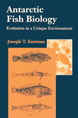 eBook - PDF
Antarctic Fish Biology
Evolution in a Unique Environment
- Joseph T. Eastman(Author)
- 2013(Publication Date)
- Academic Press(Publisher)
I The Antarctic Environment — Present and Past This page intentionally left blank 1 Physical and Biological Characteristics of the Antarctic Marine Environment ^ f JfcM^i^; -,, > I· The Antarctic Continent w H M J The Antarctic landmass covers 14 million km 2 , about twice ^ F the size of Australia, and is isolated by large expanses of cold ocean from all other land except the southern tip of South America (Fig. 1.1). The Transantarctic Mountains divide the continent into a larger East Antarctica and a smaller West Antarctica, the latter located entirely within the Western Hemisphere (Fig. 1.2). Partially detached from the rest of the continent by the embayments of the Weddell and Ross Seas, West Antarctica is a moun- tainous area that includes the Antarctic Peninsula. For Zoogeographie pur- poses the Weddell and Ross Seas are considered to be allied with East Antarc- tica (Nybelin, 1947, 1952; DeWitt, 1971). A. Climate Continental temperatures are usually below 0°C throughout the year in most interior as well as in some coastal regions. The world's record low tempera- ture of -89.6°C was recorded at the U.S.S.R. Vostok Station in 1983 (Phill- pot, 1985). The South Pole receives only trace amounts of snowfall; coastal regions have 40-100 cm yr _1 . Antarctica has a few small, ice-covered lakes with simple ecosystems that do not include fishes. There were freshwater fishes living on the continent 180 million years (m.y.) ago, but the modern fauna is exclusively marine. The cold, windy, and arid climate precludes the existence of fishes on the conti- nent today. B. The ice sheet Over millennia accumulated snow has become transformed into a massive continental ice sheet. This sheet averages 2160 m in thickness and covers all 3 I. The Antarctic Continent 5 Figure 1.2 Antarctica with major geographic features mentioned in the text. Scientific sta- tions are also indicated. The Antarctic Circle is located at 66.5°S. eBook - ePub
- Roberts Peder, Lize-Marié van der Watt, Adrian Howkins, Roberts Peder, Lize-Marié van der Watt, Adrian Howkins(Authors)
- 2016(Publication Date)
- Palgrave Macmillan(Publisher)
In the time of the ancient Greeks an Antarctic continent was presumed to exist in order to counterbalance the landmasses of the northern hemisphere, its existence both natural and necessary—but its precise nature entirely unknown. 5 For Captain James Cook in the 1770s, Antarctica was sufficiently remote and icebound to be presumed useless, 6 even though a boom and bust in fur seal hunting would ensue around the Antarctic Peninsula within 50 years of his gloomy pronouncement—followed more than a century later by the dramatic rise and fall of the Antarctic whaling industry. For explorers of the so-called “Heroic Age” (stretching roughly from 1895 to the First World War), Antarctica’s harsh and seemingly monolithic remoteness made it a perfect setting for races to traverse territory and obtain scientific data in the service of personal and national glory. 7 For interwar empire-builders such as Leo Amery of Great Britain, Antarctica was another swathe of the earth awaiting European annexation and dominion, science working hand in hand with development. 8 For earth scientists in the post-1945 years, Antarctica represented a treasure trove of geological and geophysical data (and in many imaginations, of treasure in the form of uranium and other strategically important minerals), ultimately becoming a space for Cold War competition without recourse to guns or missiles. 9 And during much of the 1980s, dissenting opinions on whether Antarctica ought to be governed by the states who were part of the ATS, or by a genuinely global body such as the United Nations, brought to the fore the continent’s status as a colonized space in addition to a potential natural resource base. 10 Antarctica’s present-day status as a continent for science and peace is merely the latest in a series of frames for understanding what kind of space the Antarctic is—and what kind of space it ought to be. This raises another set of questions eBook - ePub
The Global Commons
An Introduction
- Susan J. Buck(Author)
- 2017(Publication Date)
- Routledge(Publisher)
Chapter 3AntarcticaGreat God! This is an awful place! —Robert F.Scott (1912)The “highest, driest, windiest, and coldest continent,”1 Antarctica is so inhospitable that it has no native terrestrial mammals. The region was first explored and exploited in the late eighteenth century, but the development of a regime did not begin until late in the nineteenth century. Bound by fairly clear geographical limits and governed by a treaty system that originated with scientific exploration, Antarctica presents the most coherent regime of all the global commons.There have been few practical demands on the continent itself; until recently, its principal value has been as a location for scientific research. In 1959, Antarctica was designated an international scientific reserve in the Antarctic Treaty by the twelve nations conducting scientific research on the continent (Argentina, Australia, Belgium,Chile, France, Great Britain, Japan, New Zealand, Norway, South Africa, the Soviet Union, and the United States). Recent discoveries that suggest the presence of substantial oil, gas, and mineral supplies on the Antarctic outer continental shelf have strained relations among the signatories, and a 1989 oil spill alerted environmentalists to the dangers of ecotourism. These new developments may bring substantial change to the existing treaty system.This chapter begins with the history of the Antarctica region. Factors that discouraged the formation of a management regime before 1959 include conflicts over sovereignty, international tensions, internal bureaucratic conflicts, and a lack of American leadership. The next sections cover the origins of the International Geophysical Year (IGY) and its effect on the formation of the management regime. The formation of the Special Committee on Antarctic Research (SCAR) and the subsequent Antarctic Treaty are discussed next. The Antarctic Treaty System (ATS) and its administrative apparatus are described, as are the efforts of some developing nations to convert the treaty system into a United Nations regime. Finally, the rationale that underlies the treaty regime is discussed. eBook - ePub
The Seventh Continent
Antarctica in a Resource Age
- Deborah Shapley(Author)
- 2013(Publication Date)
- RFF Press(Publisher)
4Cook and later explorers sailed south and, as the Southern Cross rose in the night sky, they encountered many obstacles. In the latitudes of the "roaring forties" strong westerly winds propelled them swiftly across the vast southern seas. Farther south lay the "furious fifties," a belt of heavy seas and storms at 50° to 55° south latitude. Scott, steering south in 1910 in the heavily laden Terra Nova , crossed this belt with the ship's boiler room flooded. Some of the dogs and ponies tethered to the decks were throttled by the ship's rolling, and one pony was washed overboard by a big wave, only to be hurtled back again by the next.5Scott's ponies were the victims of one of the most important features of the earth's oceans, the Antarctic Convergence (or Polar Front). The Convergence marks the northern limit of the Southern Ocean (sometimes called the Antarctic Ocean) surrounding the continent. Here the great water masses of the southern Pacific, Atlantic, and Indian oceans collide with the cold Antarctic surface water that constantly is being refreshed by ice melt. The resulting turbulence creates an oceanic barrier that, except for whales, most marine organisms never cross; it contains Antarctica's rich ecosystem in a single region having one-fifth of the world's ocean water.South of the Convergence lay still more storms, but the pack ice became the explorers' chief hurdle. Pack ice, formed from freezing sea water, is constantly moving. Driven about by the winds, it is capable of slashing the hull of an unlucky or unwary ship. Thus, Antarctic explorers, even in the twentieth century, have preferred wooden ships to steel ones: metal buckles in the ice's terrific squeeze, whereas wood merely bends, allowing the hull to ride up on the ice and be spared—an uneasy truce between Antarctica and its would-be conquerors. The pack ice trapped the little Belgica in 1898, forcing the party to winter over, a stay that brought scurvy, depression, and, in some cases, madness to the crew. The Weddell Sea pack trapped Ernest Shackleton's ship Endurance in 1915, and finally crushed it, forcing his party ashore. Shackleton himself set off on a journey of more than 2,080 kilometers to get help.6 eBook - ePub
- Bruno David, Thomas Saucède(Authors)
- 2015(Publication Date)
- ISTE Press - Elsevier(Publisher)
DEB 14 ]. The physicochemical parameters of these ecosystems have long been measured, but the development of new tools, such as satellite imaging, means that it is now possible to take continuous readings of certain parameters. These advances help to define the importance of the Southern Ocean in global ocean circulation. They will thus lead to a better understanding of the role of this ocean in the evolution of ancient climates, but also in modern climatic changes.2.1 An ocean with undefined limits
Literally poles apart, the Arctic and Antarctic polar regions are situated in opposing geographical contexts. In the north, the Arctic Ocean occupies a central position. The geographical North Pole is in the middle of this ocean, where it is almost 4,000 meters deep, and the shores of the ocean correspond to the northern borders of the American and Eurasian continents. In Antarctica, it is the continent that occupies the polar position. The geographical South Pole peaks at an altitude of 2,835 m in the center of the continent, 1,300 km from the nearest coast. Antarctica is thus the most isolated continent on the planet. Its coasts are around 1,000 km from South America, 2,500 km from Australia and 4,000 km from Africa.The Southern Ocean is a unique stretch of water circling the globe without interruption between latitudes 45° and 55° South, connecting the southern parts of the Atlantic, Indian and Pacific oceans. It can even be seen as the heart of the World Ocean, with the Atlantic, Indian and Pacific oceans as its northern extensions. The Southern Ocean does indeed play a central role in the circulation and renewal of global ocean waters [ORS 95 ]. In contrast with the Arctic, this ocean does not have clearly identifiable geomorphological limits and, since its hydrological borders are mobile (ocean fronts), no fixed, indisputable geographical boundaries can be defined that all countries will recognize. Since 2000, the Southern Ocean has been identified by the International Hydrographic Organization (IHO) as an ocean in its own right, which was not previously the case, bordered in the south by the Antarctic continent. To the north, however, the definition of its borders has not yet reached a consensus and so, depending on the country and the interests involved, the northern geographical limit of the Southern Ocean can either be a coastline (e.g. the south Australian coast, for Australians), or a parallel (between 60° S and 35° S, depending on the country). The 60° parallel south is thus recognized as the northern limit, but only by 14 countries (IHO circular letter of June 1st , 1999). Rather than adopting the official geographical limits motivated by each country’s economic and political interests, oceanographers and biologists prefer the hydrological boundaries that represent natural borders, structuring marine biodiversity. For scientists, the Southern Ocean extends from the shores of Antarctica in the south to the Polar Front in the north. These were, in fact, the limits used by the Census of Antarctic Marine Life (CAML), an international program to inventory Antarctic marine biodiversity, and by the Commission for the Conservation of Antarctic Marine Living Resources (CCAMLR) [GRA 06 ]. When measured using the limits adopted by oceanographers and biologists, the Southern Ocean covers nearly 35 million km2 , or 10% of the planet’s ocean surface [GUT 10 ]. In terms of area, it is the fourth largest ocean, after the Pacific, Atlantic and Indian oceans, but still ahead of the Arctic Ocean, which is by far the smallest (14 million km2 eBook - PDF
- Antoni G. Lewkowicz(Author)
- 1999(Publication Date)
- University of Ottawa Press(Publisher)
Almost certainly, the existing conservation agreements on ter-restrial and marine resources and the current ban on mineral exploitation for fifty years are easier to implement when no-one depends directly on the resources. Thus even the present political co-operation over the Antarctic may have its roots in the physical isolation of the continent. Conclusions This paper has focused on the distinctive evolution of the antarctic polar environment and the way this underpins both the physical and human geography of the continent. Perhaps in conclusion it is worth highlighting 43 DAVID SUGDEN Figure 3.7 Distribution of bases operating in Antarctica during the winter of 1997. Numbers refer to the bases listed in Table 3.1. the role of plate tectonics in leading to the isolation of the Antarctic at the South Pole. This led to the development of the circumpolar ocean current which triggered the growth of glaciers. Over long time periods the ice grew, and as it did, both the climate of the Antarctic and, through its con-tribution of Antarctic Bottom Water to the oceans, world climate cooled. Today the circulation of global climate and the oceans, and indeed sea level itself, is influenced by the Antarctic ice sheet. This long evolution has led to the development of a polar ecosystem which has broad simi-larities to that in the Arctic, but also distinct differences related to the isolation of the continent and its rich oceanic inheritance. The importance of its isolation may even affect our political organisations today. Yes, there are differences between the Antarctic and the Arctic. The former is a continent, the latter an ocean basin; the Antarctic is higher, colder and has experienced full polar conditions for much longer; it sup-ports the bulk of the world's land ice and has evolved a rich ecosystem focused on the ocean. But when stressing the differences, it is wise to remember the similarities which underpin all life and activity in the polar regions (Ambio, 1989). eBook - PDF
Antarctica
Music, Sounds and Cultural Connections
- Bernadette Hince, Rupert Summerson, Arnan Wiesel, Bernadette Hince, Rupert Summerson, Arnan Wiesel(Authors)
- 2015(Publication Date)
- ANU Press(Publisher)
1 Introduction: Listening to Antarctica Tom Griffiths 1 In 2011, we commemorated a series of Antarctic anniversaries: the centenary of Douglas Mawson’s Australasian Antarctic Expedition, 100 years since the attainment of the South Pole, 75 years since the coming into force of the Australian Antarctic Territory and 50 years since the ratification of the Antarctic Treaty. On planet Earth today, it could be said that we inhabit the Antarctic moment. Each year now, tens of thousands of tourists visit a realm that, just a few generations ago, was virtually unknown. Over the past century we have learned just how different is the Antarctic from the Arctic, and Antarctica has moved from the geographical periphery of our consciousness to the centre of our scientific and intellectual concerns. The physics and politics of global warming have turned our eyes towards the great southern ice cap, which has 90 per cent of the world’s land ice and 70 per cent of the globe’s fresh water. The same industrial capitalism that has unleashed carbon has given us a planetary consciousness that reveals a calving berg as not just a random, local act of nature, but instead as the frightening frontier of a possibly irreversible global, historical event. Understanding ice — its history and its future — has turned out to be a key to understanding climate change and to securing a human future. The great white continent has never before gripped our imagination or dictated our destiny with such power. It is a great pleasure to contribute to this volume, which follows a wonderful Antarctic Music Festival in Canberra in 2011 involving so many talented thinkers and performers. This event stimulated us to consider what it is that constitutes the culture of the ice. It also reminded us that Antarctica presents a cultural challenge to us, as well as a scientific and political one.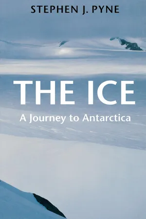 No longer available |Learn more
The Ice
A Journey to Antarctica
- Stephen J. Pyne(Author)
- 2016(Publication Date)
- University of Washington Press(Publisher)
As a new science, geology had already been pioneered, strengthened by comparisons among the six explored continents. Since Antarctica offered far less potential information than other continental bodies, it soon became apparent that perhaps the most remarkable fact about Antarctic rocks and geography was not their novelty but their familiarity. The most prominent Antarctic fossil, Glossopteris, was well known from other locales throughout the Southern Hemisphere. Antarctic mountains were quickly aligned with others: the Antarcandes with the South American Andes, and the Transantarctics of Victoria Land with the Great Dividing Range of Australia. The petrology of Antarctic rocks looked like those of any other suite, even to the point—moderately puzzling—of showing not only similar processes but similar paleo-climates. West Antarctica was readily matched with Pacific-American patterns of orogeny, East Antarctica with continental shields like those in Africa, Australia, and India. Speaking of the Terra Nova expedition, Debenham remarked that its “geological work” was “particularly comprehensive and was one of the chief items in the scientific syllabus of the Expedition.” 3 Such an emphasis was itself traditional: for a century, geology and geography had been inextricably allied with the exploration of the world’s continents. But there was, equally, a constant stream of apologias about the value of this work. In Antarctica, geology in the service of national empire offered little beyond national pride and the intrinsic value of public patronage for the sciences. There were laments that the public really wanted sagas of adventure, not science; that “no scientist,” as an exasperated Taylor once put it, “ever needs to be converted to a belief in the value of Antarctic exploration.” 4 Yet it appeared that few geologic breakthroughs would occur as a result of Antarctic geoscience, no intellectual equivalents to a march on the pole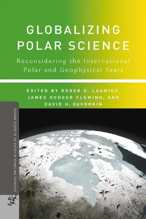 eBook - PDF
Globalizing Polar Science
Reconsidering the International Polar and Geophysical Years
- R. Launius, J. Fleming, D. DeVorkin, R. Launius, J. Fleming, D. DeVorkin(Authors)
- 2010(Publication Date)
- Palgrave Macmillan(Publisher)
These claims had been motivated, at least in part, by the belief that Antarctica might prove to be a frozen El Dorado, brimming with vast mineral wealth. 5 The United States and the Soviet Union refused to recognize any claims to sovereignty in Antarctica, while reserving their rights to possession of any part of the continent. In the Antarctic Peninsula region, directly to the south of South America, the claims of Great Britain, Argentina, and Chile substantially overlapped (figure 13.2). During the 1940s and 1950s, these overlapping claims led to a 20-year period of intense dispute, which on more than one occasion threatened to turn violent. 6 During the IGY, 12 nations participated directly in Antarctic research: the seven claimant countries, the two superpowers, South Africa, Japan, ADRIAN HOWKINS 246 and Belgium. Within a year of the conclusion of the IGY, these same 12 nations met in Washington, D.C., to sign the Antarctic Treaty, which effec- tively “internationalized” Antarctica as a “continent dedicated to peace and science.” 7 Article IV of the Antarctic Treaty suspended (or “froze” in the official pun of the conference) all sovereignty claims to the continent for the treaty’s duration, bringing to an end the active phase of the dispute among Great Britain, Argentina, and Chile. To many people at the time, it appeared as if the idealism of science had triumphed over politics. 8 This achievement was all the more remarkable for bringing the two superpowers together at the height of the cold war. Historians have tended to follow this idealistic interpretation of the connection between the IGY and the Antarctic Treaty, and the southern continent tends to be held up as an all-too-rare example of scientific cooperation leading to political harmony.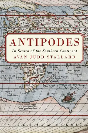
- Avan Judd Stallard(Author)
- 2016(Publication Date)
- Monash University Publishing(Publisher)
Tis meant that the prospective southern continent must be divided in two, separated by a huge frozen Antarctic sea fed by enormous rivers fow-ing from high mountain chains in the Antarctic lands (see Figure 9.3). Yet though ice dominates Buache’s conception of southern lands, there was still 9 Buache, “Geographical and Physical Observations,” p. 33. ANTIPODES: IN SEARCH OF THE SOU THER N CONTINENT – 204 – sufcient room for sanguine hopes of fne and fertile country and climate, and Buache discusses various traces of empirical data that convinces him that this must be so. No longer available |Learn more
- (Author)
- 2014(Publication Date)
- University Publications(Publisher)
An 1849 atlas labelled Antarctica as a continent but few atlases did so until after World War II. From the mid-19th century, United States atlases more commonly treated North and South America as separate continents, while atlases published in Europe usually considered them one continent. However, it was still not uncommon for United States atlases to treat them as one continent up until World War II. The Olympic flag, devised in 1913, has five rings representing the five inhabited, participating continents, with America being treated as one continent and Antarctica not included. From the 1950s, most United States geographers divided America in two – consistent with modern understanding of geology and plate tectonics. With the addition of Antarctica, this made the seven-continent model. However, this division of America never appealed to Latin America, which saw itself spanning an America that was a single landmass, and there the conception of six continents remains, as it does in scattered other countries. ________________________ WORLD TECHNOLOGIES ________________________ In recent years there has been a push for Europe and Asia together to be considered a single continent, dubbed Eurasia. In this model, the world is divided into six continents (if North America and South America are considered separate continents). Geology Geologists use the term continent in a different manner from geographers, where a continent is defined by continental crust: a platform of metamorphic and igneous rock, largely of granitic composition. Some geologists restrict the term 'continent' to portions of the crust built around stable Precambrian shield, typically 1.5 to 3.8 billion years old, called a craton. The craton itself is an accretionary complex of ancient mobile belts (mountain belts) from earlier cycles of subduction, continental collision and break-up from plate tectonic activity.
Index pages curate the most relevant extracts from our library of academic textbooks. They’ve been created using an in-house natural language model (NLM), each adding context and meaning to key research topics.