Geography
Alaska
Alaska is the largest state in the United States, known for its vast and diverse geography, including mountains, forests, and tundra. It is home to the highest peak in North America, Mount Denali, and has a rugged coastline with numerous fjords and glaciers. Alaska's unique location also makes it a prime spot for viewing the Northern Lights.
Written by Perlego with AI-assistance
Related key terms
1 of 5
6 Key excerpts on "Alaska"
 eBook - ePub
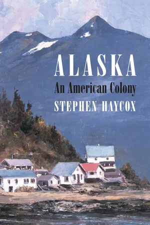
Alaska
An American Colony
- Stephen W. Haycox(Author)
- 2017(Publication Date)
- University of Washington Press(Publisher)
Introduction: Alaska Geography and the Anthropology of Its Native PeoplesA history of Alaska must appropriately begin with a discussion of the region’s geography and aboriginal populations that have inhabited that geography since the end of the last mass glaciation of the Northern Hemisphere, the last ice age, more than ten thousand years ago.1 In analyzing the events that constitute Alaska’s human history, it is important to know where these developments occurred. This is important not just in terms of macrogeography, the relationship of broad regions with one another, but also with respect to the biotic character of the land, the natural environment. All human history is conditioned by the environment in which it takes place; the evolution of people and culture does not take place in a vacuum but in the very real context of the natural landscape and how the people who live in that environment relate to it. The people who inhabit a particular area develop an identity with it, one that helps form their view of themselves. In fact, a profound sense of place is a part of the fundamental identity of both people and cultures. To ignore the physical geography, the landscape in which cultural evolution takes place, would lead to a false understanding of that process and of the people who manifest it. Thus the role of place, and how people express their relationship to it, is a recurring focus of this book.At 375 million acres (586,000 square miles), Alaska is so large, its size almost defies comprehension. Although its shape as rendered on a map becomes familiar to those who live in the state and repeatedly see it depicted, that shape hardly conveys real meaning, particularly when it is cut off at 141 west longitude and along the crest of the coastal mountains adjacent to the Alexander Archipelago, as if there were nothing but a white vacuum to the east. Irritating too is the frequent placement of the Aleutian Islands on maps in a box in the Gulf of Alaska, another problem that highlights the impossibility of meaningfully assimilating the region’s vast size. Alaska’s shape and size are results of judgments made in the early nineteenth century by European and American diplomats, and today these dimensions are readily recognized by only a few Alaskans; the focus of most Alaskans is on their immediate local geography, not on where they are in a broader context. eBook - ePub
The Circumpolar North
A Political and Economic Geography of the Arctic and Sub-Arctic
- Terence Armstrong, George Rogers, Graham Rowley(Authors)
- 2023(Publication Date)
- Routledge(Publisher)
Since the mid-twentieth century mark, however, Alaska has expanded rapidly in population, and in economic and political development. A contemporary American society and polity appears to be emerging in Alaska, as hoped for by the romantics and visionaries of the last century, but its character and the path of its evolution contradicts the blueprints of public policy and private dreams. For reasons of physical geography and market remoteness, Alaska could not follow the evolution of an agricultural-based society, but it has found a path leading directly towards development of a twentieth-century urban society. The current popular belief that the future rather than the past will set the Alaskan patterns of development is implied in the latest Alaskan slogan, ‘North to the Future'. But the process by which this will be achieved is an evolutionary one and there is a present danger that popular and official views may be based simply upon the exchange of one set of myths concerning a pioneering past for another set inspired by futurology.Geographical background
The Alaska Boundary Settlement of 1903 between the United States and Great Britain established the political boundaries. So defined, Alaska is a large peninsula bounded by the Arctic Ocean on the north, the Bering Sea on the West, the Gulf of Alaska and the North Pacific Ocean on the south, and the 141st meridian and the crest of the Coast Range on the east (Map 14 ). The total land area is 586,400 sq miles (1,520,000 sq km), stretching out between latitudes of 51° and 72° N and the meridians of 130° W and 173° E, and containing four time zones. The 1964 Convention on the Continental Shelf (submarine areas adjacent to the coast to a depth of 200 m) added 550,000 sq miles (1,430,000 sq km) of sea bed and its resources to the land and resource base of Alaska, 65 per cent of the total United States' continental shelf.Alaska is not a single homogeneous region but several distinctive regions. The Pacific Mountains System defines the northern and eastern coasts of the Gulf of Alaska and the North Pacific Ocean and the southern border of Alaska. It is a continuation of the continental system swinging northward through coastal British Columbia into Alaska as the Alexander Archipelago and Coast Range of southeastern Alaska, and sending off two spurs as it continues west and southward in an arc across the Gulf of Alaska. The coastal spur contains the St Elias Range with peaks reaching up to 19,000 feet (5,800 m) above sea level, the Chugach and Kenai Mountains, and Kodiak Island. The main spur forms the Alaska Range culminating in 20,300-foot (6,200 m) Mt McKinley, and continuing south and westward as the backbone of the Alaska Peninsula and the Aleutian Islands. Between these two spurs lie the Inside Passage and other waterways of southeast Alaska, the Wrangell Mountains, Copper River plateau, the Talkeetna Mountains, the Susitna lowlands and Cook Inlet. The region is part of the Pacific ‘rim of fire' and includes several active volcanoes. It has been subject to frequent and at times destructive eruptions, earthquakes, and tsunamis. The most recent were the 1964 Good Friday earthquake centered near Valdez and felt throughout south central Alaska (8.3 on the Richter scale) and the related tsunami which destroyed Valdez and other coast villages, and did damage as far south as California. eBook - ePub
- Jean-Marc Zaninetti(Author)
- 2013(Publication Date)
- Wiley-ISTE(Publisher)
2 ) remains below the world average.The population is very unevenly distributed (see Figure 1.1 ). The permanent imbalance between East and West can first be explained by the history of the country, but many other elements are explained as a matter of location and environment.Geographical determinism is particularly important for the two peripheral states in the Pacific region.Alaska is largely unoccupied, due both to its location and to its environment. It is a remote, peripheral territory, located in the extreme northwest of the continent on the opposite side of the territory from the area first settled by Europeans. It is also a boreal region with a very hostile climate; it is mostly barren, very mountainous (Mount McKinley, 6,194 m), volcanic, and highly prone to seismic activity. Access is very difficult; only the southern coast is free of ice all year round. As the “last frontier” for American pioneers, Alaska is nonetheless a highly coveted territory due to its wealth of natural resources, particularly hydrocarbons.The Hawaiian Islands benefit from a tropical climate with relatively favorable trade winds since they are outside the path of major hurricanes in the Pacific. They are, however, a mountainous region of volcanic origin with highly active, though not eruptive, volcanoes. Populated areas are therefore concentrated along the coast. Freshwater resources in volcanic regions are typically scarce, particularly on the leeward coast.It is also an ultra-peripheral region which lived in total isolation until the 19th century. Its intermediary position between America and Asia earned strategic interest during the imperial period of 1895–1945, which led to a mixed population of indigenous Polynesians, American settlers of European origin, and immigrants from Asia, particularly Japan. eBook - PDF
The Impact of Geology on the United States
A Reference Guide to Benefits and Hazards
- Angus M. Gunn(Author)
- 2001(Publication Date)
- Greenwood(Publisher)
3 Alaska Alaska stands apart from the other 49 states in many ways, especially in relation to the main theme of this book, the impact of geology and associated climatic elements on U.S. environments; it is the volcanic capital of the nation, with more active or potentially active volcanoes than all the other states put together. There are two reasons why the media do not focus as sharply on eruptions here as they do on the coterminous United States. The first is because most eruptions occur in thinly populated or unpopulated areas, along the Aleutian chain of islands. Second, only a small number of people are affected even in the main settled areas; there are only 1 million people in the whole of Alaska. Curving westward from Anchorage for 1,000 kilometers is the Alaska Pen- insula, and beyond it for a further 1,500 kilometers lie the Aleutian Islands. It is on this curve, marking the boundary between Pacific and North American plates, that the majority of volcanoes lie. The islands of the Aleutians are all created by subduction on the part of the Pacific plate. These distances are in- dicative of the enormous size of the state of Alaska, in area more than twice the size of any one of the other 49. No less impressive is the number of volcanic eruptions over this 2,500 kilometers of territory during the past 200 years, on average, one every year. We will study some of these eruptions. Because of its northerly location, Alaska is dominated by the problem of permafrost, ground that is frozen to some degree all through the year. No other state has to cope with this particular problem. It is something that affects every- thing in the day-to-day lives of its inhabitants. Only the fringes along the south and southeast coasts are free from this condition. Even more serious for Alas- kans is the threat of global warming because whenever the world's average temperature rises 1 degree, Alaska's rises 1.1 or more because of world patterns eBook - ePub
Converging Empires
Citizens and Subjects in the North Pacific Borderlands, 1867–1945
- Andrea Geiger(Author)
- 2022(Publication Date)
- The University of North Carolina Press(Publisher)
Introduction
Along the northwestern edge of North America, where the continent meets and extends out into the North Pacific Ocean, lies an area that was long omitted or deliberately obscured on early European maps because its contours were unknown to those who drew them.1 Located, at various times, at the farthest edges of the Russian, British, Spanish, and American empires, the rocky coast of the continent gives way to a series of islands that reach across the North Pacific to connect it to Asia. Along the shores of what are now the Alaska panhandle and British Columbia, a series of archipelagos protects much of the mainland from the direct impact of the great waves that have made the journey across the Pacific Ocean. Made up of hundreds of densely forested islands and misty, interconnected channels carved into the landscape by glacial retreat, these archipelagos are home to ecologically rich and strikingly beautiful landscapes that extend from what is now the Washington coast to the Gulf of Alaska.2 Further west, the cedar, pine and fir-covered islands of southeast Alaska and British Columbia give way to a rockier and more austere landscape marked by glaciers that tie land to sea along Alaska’s southern coast. At the end of the Alaskan peninsula, the Aleutian island chain stretches further westward still, dividing the Pacific Ocean from the Bering Sea and linking the continent of North America to the Kamchatka Peninsula. The Kuril Islands, in turn, extend south and west to connect the Kamchatka Peninsula to the island of Hokkaido. Taken together, these islands sketch an arc across the North Pacific Ocean that is testament to the interconnected nature of the continents of Asia and North America— eBook - ePub
Electronic Quills
A Situated Evaluation of Using Computers for Writing in Classrooms
- Bertram C. Bruce, Andee Rubin, with contributi Barnhardt and Teachers(Authors)
- 2013(Publication Date)
- Routledge(Publisher)
Chapter 4The Alaskan Context
A critical aspect of a situated evaluation is an analysis of situations in which an innovation is realized. Characteristics such as classroom organization, the teacher’s background and educational approach, the students’ backgrounds, the amount and configuration of technology in the classroom, and the organization of the individual school have an obvious impact on what actually happens in a classroom. More global characteristics, such as the influence of state educational agencies, the relationships among schools, and ethnic and linguistic aspects of the larger community, also shape classroom practices. Any realization of an innovation develops from an interaction among these contextual features and the “packaged” innovation received by the teacher. Accordingly, in this chapter we describe our perspective on Alaska, its history, and the growth of its educational system.A first glance at Alaska highlights its extremes—the largest area, the smallest population and population density, the highest mountain, a large number of linguistically and ethnically diverse populations, and the most northern, most western, and most eastern locations in the United States. It is thought of as “the last frontier,” a state full of rugged individualists and small Native communities, where transportation challenges have played a large part in determining the flow of everyday life. Alaskans, too, see their state as separate, referring to the continental United States as “Outside” or “The Lower 48.”The possibility of generalizing from an experience in Alaska to classrooms in the rest of the United States seems at first difficult, if not impossible. But the issues central to education in Alaska in 1983 were similar to those that were becoming prominent elsewhere in the United States: increasing cultural and linguistic diversity, increased investment in technology, movements toward decentralization and local control, and shrinking community tax support for education. In fact, Alaskan schools were dealing with the implications of linguistic and cultural diversity years before they became national educational priorities. The rest of the country is just now facing the impact of the influx of recent immigrants, as their children enter the schools in growing numbers. Alaska’s experiences can serve as a reference point as other states attempt to integrate bilingual, multicultural, and traditional education.
Index pages curate the most relevant extracts from our library of academic textbooks. They’ve been created using an in-house natural language model (NLM), each adding context and meaning to key research topics.