History
Lewis and Clark Expedition
The Lewis and Clark Expedition, also known as the Corps of Discovery Expedition, was the first American overland expedition to the Pacific coast and back. Led by Meriwether Lewis and William Clark, the expedition took place from 1804 to 1806 and aimed to explore and map the newly acquired western territory of the United States, as well as establish trade with Native American tribes.
Written by Perlego with AI-assistance
Related key terms
1 of 5
11 Key excerpts on "Lewis and Clark Expedition"
 eBook - PDF
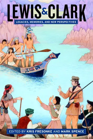
Lewis & Clark
Legacies, Memories, and New Perspectives
- Kris Fresonke, Mark Spence, Kris Fresonke, Mark Spence(Authors)
- 2004(Publication Date)
- University of California Press(Publisher)
part i Contexts Map 2. A map of Lewis and Clark’s track across the western portion of North America from the Mississippi to the Pacific Ocean by order of the executive of the United States in 1804, 5, & 6. By Samuel Lewis, 1814, from the original drawing of Wm. Clark, 1810. (American Philosophical Society) Based on William Clark’s careful observations, and augmented with information from the 1805–7 expedition of Zebulon Pike, this full-scale map of the entire Lewis and Clark trail is crowded with references to rivers, mountain ranges, and Native groups. Clark added new details to an original version of this map throughout a thirty-year career that combined his private interests in the fur trade with his official obligations as an Indian agent and superintendent of Indian affairs for the Upper Louisiana Territory. The updated map that he kept in his offices in St. Louis served as a guide to fur trading enterprises, policy makers, and military planners for nearly half a century. T hough largely neglected by scholars and the general public for most of the nineteenth century, the Lewis and Clark Expedition has at-tracted a great deal of attention since the centennial celebrations of 1904 and 1905. It would seem that the past one hundred years might be enough to exhaust the subject. After all, the expedition has a clear begin-ning and end, the route across the continent is well known and docu-mented, various issues of the journals are widely available, and hundreds of authors have already written about the subject. Yet the increasing flood of books, articles, and films on the expedition suggests there may be no end to the appeal of Lewis and Clark and the ways it can be described or interpreted. The most remarkable feature of writings on Lewis and Clark is not the sheer volume of material, but its narrow scope.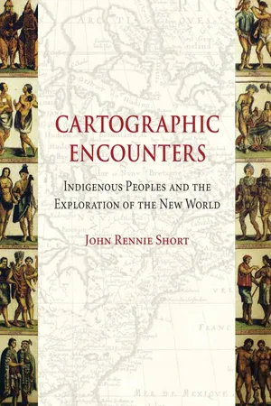 eBook - ePub
Cartographic Encounters
Indigenous Peoples and the Exploration of the New World
- John Rennie Short(Author)
- 2012(Publication Date)
- Reaktion Books(Publisher)
PART III | imperial cartographies18 Cut Nose’s sketch map, 1806.  Passage contains an image
5 | Surveying the West: Lewis and Clark . . . and Others
The Lewis and Clark Expedition is a hinged event that swings from the colonial to the imperial cartographies of the western United States. The expedition began when the United States was still only a fledgling nation restricted to the eastern seaboard. The expedition opened up the West to subsequent exploration that allowed the full emergence of a continental United States. Lewis and Clark inaugurated an exploratory practice with imperial reach for the new nation, as the United States staked a claim across the great continent and set about peopling the territory and commodifying the land. In the wake of Lewis and Clark, the Republic extended beyond the original thirteen colonies, west across the Mississippi to the Pacific Ocean, south to Mexico and north to Canada. This territorial annexation also involved the land’s incorporation into national discourses of cartographic knowledge, scientific understanding, political control and economic calculation. The land required survey in all the subtle meanings of that term, including knowing, surveillance and control.Before Lewis and ClarkOn 20 June 1803 Thomas Jefferson sent a letter to Captain Meriwether Lewis outlining the goals of an expedition into the interior of the country. ‘The object of your mission’, it began, ‘is to explore the Missouri river, & such principal stream of it, as, by it’s course and communication with the waters of the Pacific ocean.’Much has been written about this expedition that travelled from St Louis through the Rocky Mountains to the Pacific and back; it is now represented as a foundational expedition in the history of the United States. There is a vast body of documentation; here I will limit my remarks to noting the Amerindian cartographic contribution, which was significant. At least 30 Native American maps have been identified in the records of Lewis and Clark. And even before they left Washington, Lewis and Clark drew upon a large measure of Native American geographic knowledge encoded into the various maps that informed and guided their journey.1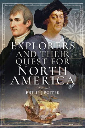 eBook - ePub
- Philip J. Potter(Author)
- 2018(Publication Date)
- Pen & Sword History(Publisher)
Meriwether LewisShortly after the American acquisition of the vast Louisiana Territory from France in 1803, the Corps of Discovery Expedition was commissioned by President Thomas Jefferson to explore, map and search for the North-west Passage to the Pacific, while establishing the presence of the United States in the area. To lead the expeditionary force into the unknown country, the president appointed his secretary, Captain Meriwether Lewis, as commander. In the spring of 1804, the Americans crossed the Mississippi River to begin the voyage up the thick and muddy waters of the Missouri River into the Louisiana Territory in a 55 feet keelboat. Under Lewis’ command, the arduous and perilous journey across the continent and return to St Louis lasted from May 1804 until September 1806, and gave the nation a vivid description of the region’s wide-ranging and diverse geography, Indian cultures, animals and vegetation, while producing the first charts of America’s newly purchased land.Meriwether Lewis was born on his family’s plantation of Locust Hill in Albemarle County, Virginia, on 18 August 1774, the son of William and Lucy Meriwether Lewis. The young Meriwether grew up in the affluent region of Virginia, and was close neighbours with the families of the Jeffersons, Madisons and Randolphs. Meriwether Lewis came from a family with many illustrious relatives, who had served with distinction in the French and Indian and American Revolutionary wars. William Lewis fought for the colonials during the revolution, dying in 1779 from pneumonia while on active duty. The death of his father, along with the redcoats’ looting of Albemarle County, created in the young Meriwether a lifelong anti-British sentiment. Six months after the death of her husband, Lucy Lewis married Captain John Marks, moving her family with him to Georgia in May 1780 and settling in the Goose Pond community of Oglethorpe County in the northeastern section of the colony. While living in the Broad River area of the county, Meriwether Lewis was occupied hunting and fishing in the woodlands, developing into a skilled hunter and outdoorsman, while learning how to survive in the wilderness. He studied the county’s natural history, investigating the local vegetation and wildlife, while nurturing an interest in edible plants. In Georgia he had numerous contacts with the local Native Americans, supporting their claims to their traditional tribal lands against the encroachments of the colonists.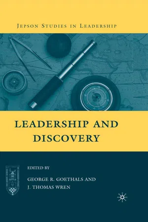 eBook - PDF
- G. Goethals, J. Wren(Authors)
- 2009(Publication Date)
- Palgrave Macmillan(Publisher)
Rather, Lewis and Clark’s success was largely the product of their leadership—of specific actions or habits of mind, and members of the expedition left such an abundance of evidence that two centuries later it is possible still to identify many of those actions Lewis and Clark, and Leadership and Discovery 65 or habits of mind and to demonstrate many of the particular qualities of leadership demonstrated by Lewis and Clark. The first, not surprisingly, was careful planning, especially by Meriwether Lewis in the months preceding his departure from Washington, D.C. in the early summer of 1803. Lewis and President Jefferson had probably been discussing a cross-continent expedition since the summer of 1802, when Jefferson acquired a copy of Mackenzie’s Voyages. 9 Serious planning did not begin, however, until Congress voted to approve the mission in February 1803. By then Lewis had some idea of what he was planning for. Having spent several years traveling between army posts along the Ohio frontier prior to assuming the duties of private secretary to President Jefferson, Lewis had some sense what a trip across the American West might be like. He also knew the journey would not be short. By 1803 the width of the American continent was fairly well established, and Lewis knew it would take at least two years to cross. As for what exactly he would encounter along the way, though, Lewis knew far less. Europeans had explored and described the Pacific coast, and fur traders had penetrated the Missouri Valley as far as the Mandan villages, in what is now North Dakota, but between those points the map was blank. There were rumors, theories, and specula- tion, but no real knowledge. Nor was there a clear understanding of how fundamentally different the West was from the North American East. Time and time again Lewis and Clark acted in ways that sug- gest they mistakenly assumed that western geography, hydrology, and weather would be much like their eastern counterparts.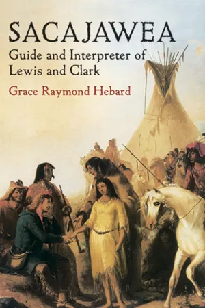 eBook - ePub
Sacajawea
Guide and Interpreter of Lewis and Clark
- Grace Raymond Hebard(Author)
- 2012(Publication Date)
- Dover Publications(Publisher)
With the Lewis and Clark ExpeditionJourneyed westward, westward, Left the fleetest deer behind him, Left the antelope and bison, Passed the mountains of the prairie, Passed the land of Crows and Foxes, Passed the dwellings of the Blackfeet, Came unto the Rocky mountains, To the kingdom of the west-wind. – HiawathaCHAPTER I
With the Lewis and Clark Expedition
The treaty by which France ceded the Louisiana territory to the United States was signed April 30, 1803, and ratified by congress on October 26 of the same year. It was not until December 20, however, that the formal transfer of the territory, embracing approximately 1,020,571 square miles, actually occurred. The cost of this enormous empire was $15,000,000, or about two and one-half cents an acre.The American most interested in this transaction, and in many ways most responsible for it, was Thomas Jefferson. As early as 1786 we find him lending his support in Paris to John Ledyard, the “Connecticut Yankee” who dreamed of crossing Asia, sailing to the northwest coast, and making his way overland to the American settlements in the Mississippi valley. Six years later, more than a decade before the confirmation of the Louisiana purchase, Jefferson, then secretary of state, began to discuss the advisability of sending an exploring party to navigate the Missouri river to its source. His object was to open commercial relations with the Indians ; secure for our government some of the riches of the region which were being monopolized by traders from Canada; discover, if possible, a waterway to the Pacific; and open a route that would enable us to share in the trade of the orient.At that time, however, no one had the slightest conception of the vastness of the territory lying beyond the Missouri, although in 1792 Robert Gray, a ship captain from Boston, had sailed around the cape to the Pacific in the ship “Columbia,” and cast anchor in the harbor at the mouth of the river to which he gave the name of his vessel. From this time on many English and Yankee ships sailed along the northwest coast gathering furs, and the region about Vancouver island thus became definitely known. But the territory between the Missouri and the Pacific was as yet unexplored except as a few adventurous trappers had ascended the Missouri river a thousand miles or so and set their steel beaver traps along its tributaries. In 1793 Jefferson engaged the services of André Michaux, a French botanist, to explore the territory between the Missouri and the Pacific, instructing him specifically to “seek for and pursue that route which shall form the shortest and most convenient communication between the higher parts of the Missouri and the Pacific ocean.” 13 eBook - ePub
- Gerald F. Kreyche(Author)
- 2021(Publication Date)
- The University Press of Kentucky(Publisher)
The Corps of Discovery, as it was to be called, was composed of a melánge of “robust, helthy, hardy” men who were distinguished by uncommon courage and uncommon skill. All were single: nine were chosen from among Kentucky’s best woodsmen, fourteen were soldiers, and two were French river experts. Pay for privates was five dollars a month and for sergeants, eight. The company also included a hunter-interpreter and Clark’s strapping black body-servant, York. Lewis and Clark themselves would complete the twenty-nine on the official list. On the first part of the journey, to the winter quarters at Fort Mandan in present-day North Dakota, they would be assisted by sixteen extra men. Thus forty-five persons would begin the adventure, travelling in the keelboat and two pirogues (dugout canoes).Clark set up first camp at Wood River (Fort Dubois), located where the giant Missouri and Mississippi rivers merged into one (serving almost as a symbol of Lewis and Clark themselves). Lewis joined the company there after catching up on last-minute details in the East. Finally, spring was in full bloom and the rivers were flowing at their highest. It was time to make the movement west.On May 14, 1804, the intrepid Lewis and Clark began a journey that would take them to the delta of the mighty Columbia River on the Pacific Ocean. In reaching their destination, they would strengthen the United States’ claim to what was later known as Oregon land, first claimed by Captain Gray and his Columbia crew in 1792. Both claims would later undergird the agitation for “Fifty-four/forty or fight!” and add to the nation the states of Oregon and Washington. The entire American movement west could be rightly viewed as “an affirmation of democracy and a doctrine of geographical determinism.”11 The phrase “manifest destiny” had yet to be coined but, as a belief that stimulated the epic adventure, it already was forcibly present.Both captains as well as the sergeants kept journals, and two privates also penned some notes along the way. On the day of departure, Clark wrote in his journal, “I set out at 4 o’clock P.M ., in the presence of many of the neighbouring inhabitents, and proceeded on under a jentle brease up the Missourie.”12 eBook - ePub
The Quest for the Northwest Passage
Knowledge, Nation and Empire, 1576–1806
- Frédéric Regard(Author)
- 2015(Publication Date)
- Routledge(Publisher)
24 Clark’s inscription was quite obviously meant to be read as a clear instance of symbolic reappropriation. The new nation’s cultural prestige was also at stake. It was made clear that the predictable success of the American Corps of Discovery would depend largely on a long and meticulous preparation whereby the Army officers would be turned into well-trained, professional explorers, in contrast to Mackenzie’s crudely pragmatic approach:I do not possess the science of the naturalist; and even if the qualifications of that character had been attained by me, its curious spirit would not have been gratified. I could not stop to dig into the earth over whose surface I was compelled to pass with rapid steps; nor could I turn aside to collect the plants which nature might have scattered on the way, when my thoughts were anxiously employed in making provision for the day that was passing over me.25Jefferson made sure Lewis learned all the theories and practices of navigation and sent him to Philadelphia to be trained by the best astronomers and cartographers. The Lewis and Clark Expedition would bring back new data about the northwest territories and would yield scientific knowledge that Mackenzie could never have anticipated.Emulation, however, would also prove a blinding force. There was one passage in Mackenzie’s journal that certainly drew Jefferson’s special attention – the crossing of the Continental Divide on 12 June 1793:Here two streams tumble down the rocks from the right, and lose themselves in the lake which we had left (Arctic Lake); while two others fall from the opposite heights, and glide into the lake which we were approaching (Portage Lake); this being the highest point of land dividing these waters, and we are now going with the stream.26Here at last was evidence that the mythic interconnection did exist. The day after this discovery, an ‘alarming scene, with all its terrors and dangers’27 eBook - PDF
- Walter W. Powell, Richard Steinberg(Authors)
- 2007(Publication Date)
- Yale University Press(Publisher)
The books all announced that they were the work of the explorers, and for one simple reason: travel narratives drew their legitimacy by claiming to be the record of the travelers, not of the editors, printers, or cartographers. Again, one can judge a book by its cover, which always established the explorers as the authors. Consider the emergence of Clark’s name. After years in which he struggled to garner some credit as Lewis’s collaborator rather than his sub-ordinate, the first page of the narrative in History of the Expedition introduced the expedition by stating that Jefferson’s “private secretary, Captain Meri-wether Lewis, and Captain William Clark, both officers of the Army of the United States, were associated in the command of this enterprise.” 12 Jeffer-son’s Message introduced “Captains Lewis and Clark, Doctor Sibley, and Mr. Dunbar” as the leaders of major federal initiatives. King produced a book “Drawn up from the Returns of Messrs. Freeman & Custis.” Finally, given 166 A World Explored Figure 24. Illustrations from Patrick Gass, Journal of the Voyages and Travels of a Corps of Discovery Under the Command of Capt. Lewis and Capt. Clarke, of the Army of the United States, from the mouth of the river Missouri through the interior parts of North America to the Pacific Ocean, during the years 1804, 1805 and 1806 (Philadelphia: Mathew Carey, 1810 and 1812). Special Collections, Washington University in St. Louis. Pike’s eagerness for advancement and glory, it was no surprise that his name appeared prominently on the cover of his account in 1810, with Peale’s por-trait of Pike smiling as he peered at the title page. The only book to assert from the start that these expeditions entailed the ef-forts of people besides their leaders was, appropriately enough, written by somebody who was not a leader. eBook - ePub
- C. Bríd Nicholson(Author)
- 2018(Publication Date)
- ABC-CLIO(Publisher)
Epidemics in Colonial America. Louisiana State University, 1971.Josephy, Alvin M. Lewis and Clark through Indian Eyes: None Indian Writers on the Legacy of the Expedition. New York: Vintage Press, 2007.Ronda, James P. Lewis and Clark among the Indians. Lincoln: University of Nebraska Press, 1984.Russel, Carl. “The Guns of the Lewis and Clark Expedition.” North Dakota History, vol. 27 (Winter 1960).Slaughter, Thomas P. Exploring Lewis and Clark: Reflections on Men and Wilderness. New York: Vintage Press, 2004.Document 18
Letter from Thomas Jefferson to Meriwether Lewis (June 20, 1803)
Introduction: Instructions for the Expedition West
Jefferson was extremely clear that much of this journey was to be spent talking to and listening to the Native American population. Jefferson once again had taken the early advice of General George Rogers Clark here and made it clear that that he (Jefferson) was sending a purposeful small group of people so that this expedition would neither be considered an act of aggressive nor even ever thought of as an act of war. Jefferson wanted detailed information about the nations who lived in the West, but these instructions were set up so that respect would be given. This was not about war or takeover of land but about science and cooperation. Jefferson believed that the Native population could be persuaded to farm the land and to live with the people from the East who would move there and also farm, but for this to happen, this trip, which was the vital beginning of the process, had to be peaceful in every way.Science was also vital here. Jefferson demanded that details of weather, rivers, streams, mountains, plants, and animals were kept. This would be part of any maps that would be made, but it was also new information. Jefferson was aware that accepted and promoted science of the time thought that American nature was physically weak and unable to cope and was less than European animals. The only way that such science could be refuted was with many accurate detailed observations eBook - PDF
Macropolitics of Nineteenth-Century Literature
Nationalism, Exoticism, Imperialism
- Jonathan Arac, Harriet Ritvo, Jonathan Arac, Harriet Ritvo(Authors)
- 2016(Publication Date)
Reading the History with the ensuing decades of conflict among the United States, British, Spanish, and Indian competitors in mind, one is able to recover how difficult it was then to write a narrative which would fulfil these kinds of national expectations. The Lewis and Clark Expedition was more or less successful, depending on how one defines its goals, but despite its achievements, the History did not manage univocally to prophesy the realization of the United States' conti-nental errand, even though it is full of evidence that such a story is what its authors would have liked to have told, and even though subsequent genera-tions have tended to view their report in these terms. The author/heroes of the History, in trying to be the American people's factotum in the West, ended up displaying in a particularly vivid way the contradictions inherent in Euro-Americans' developing imperialist relationship with the continent, and in this sense their narrative is a valuable resource for the understanding of an ideology that later would assume a much more coherent literary expression. The Lewis and Clark legend, as opposed to the History, is a particularly clear example of what Wayne Franklin calls those bland fic-tions which later generations . . . have projected onto earlier times. Too often, he argues, the plotting of the American past. . . stresses the abid-ing realization of original design, eliding the plain discontinuities, the terminations of American experience (155). The History itself, by contrast, retains clear evidence of the discontinuities and terminations which were part of Euro-American expansion into the West, terminations not only of The Discoverer's Authority in Lewis and Clark 15 indigenous ways of life but of modes of Euro-American experience, which gave way as a dominant Western rhetoric emerged. eBook - ePub
Lewis and Clark
Partners in Discovery
- John Bakeless(Author)
- 2012(Publication Date)
- Dover Publications(Publisher)
Loisel was not quite the guileless friend he seemed. Though he gave information to the Americans, he was listening carefully all the while to what they themselves had to say of their plans. A few days later, he was privately reporting to the Spaniards on the danger of American influence among the Indians; the danger of an American claim to all lands watered by the Missouri’s tributaries; the peculiar menace of the Lewis and Clark Expedition, which had “already set out to explore the way”; and, finally, the value to Spain of his own services, which he offered to combat the nefarious schemes of the United States. The former Spanish Governor rushed this to his superiors, warning that Nuevo Mexico was in danger and urging that Loisel be employed as a frontier agent to head off the Americans. At about the same time, the Spanish Governor of West Florida—much alarmed about the expedition, though not very well informed—was urging that Spanish troops be sent overland from Santa Fé or Chihuahua at once, either to capture Lewis and Clark or to force them back. His Excellency noted with dismay that already bets were being offered in Florida that the Americans would possess a Pacific port within five years.Cursing an epidemic of boils, intestinal upheavals, mosquitoes, snags, a broken mast, snapping tow ropes, lost oars—and probably, in private, their commanders—the expedition crawled upstream against the stiff Missouri current. Hunters moved along the bank, shooting for the pot and meeting occasional friendly Indians. A shore party herded the expedition’s horses, sometimes meeting loose horses on the prairie and gathering them in. Movement along the shore was not easy, for the Missouri is edged with steep bluffs of hard clay and the shore below was overgrown with thickets and trees, through which they had to fight their way. One of the officers was usually ashore. Lewis was soon off to the woods, collecting “many curious Plants & Srubs,” noting a new birdsong, finding occasional Indian sign. Clark once got so far ahead of the boats that he had to camp by the shore and wait for them. Deer were plentiful, bear began to appear, there was some buffalo sign. The party jerked such meat as it did not eat on the spot.On the 26th, the captains assigned special duties to their sergeants. One took the helm and saw that everything was shipshape, no small task for a soldier. A second commanded the guard amidships, managed the sail, watched the oarsmen, issued liquor, posted the guard, watched the shore en route, and posted the guard ashore. At each relief of the guard during the night, he reconnoitered for 150 paces around the camp with two soldiers. A third, in the bow, kept a sharp look-out for snags in the river, signals, and possible enemies. Never once relaxed, from start to finish, the expedition’s constant alertness largely accounted for its success. To take the Corps of Discovery by surprise was quite impossible, and when armed and alert, they were amply able to defend themselves against any possible attack.
Index pages curate the most relevant extracts from our library of academic textbooks. They’ve been created using an in-house natural language model (NLM), each adding context and meaning to key research topics.